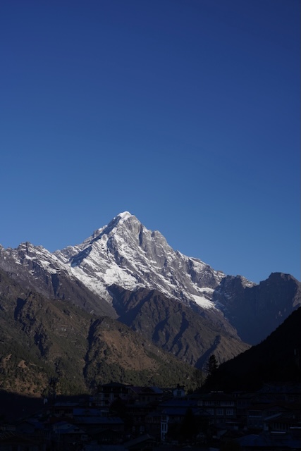
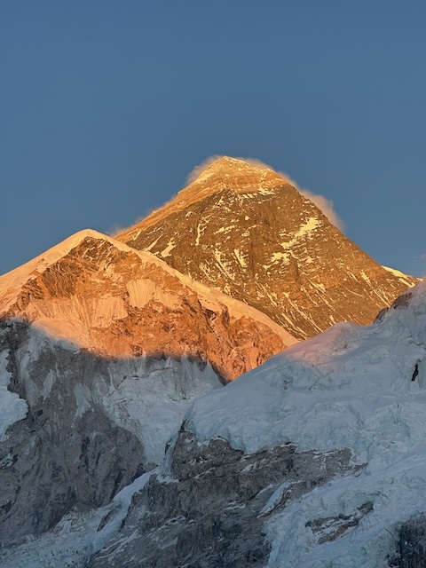
And it begins

The quickest way to start the trek is by direct flight from Kathmandu to Lukla, but in peak season flights are redirected to an airport outside the city called Ramechhap. The distance of 132 km took 8 hours by jeep over some of the rockiest terrain I’ve ever experienced. The monsoon rains last year ripped up the entire road, so it’s not for the faint of heart.

There were three of us cramped in the back of a jeep with all our baggage, and let’s just say the suspension could have done with a service. Once we arrived, we stayed at a glamping site overnight and made our way to the airport early. That guaranteed we would be on one of the earlier flights (and we were).

Let’s just say it wasn’t luxury—but hey, we were going to be sleeping in basic accommodation for the next 10 nights, so luxury was not top of the list.

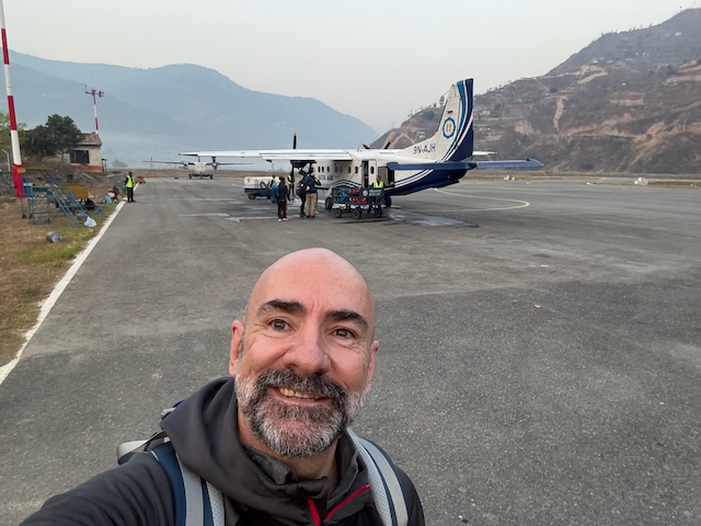
The airstrip at Ramechhap Manthali is basic, and the planes are all small form factor with very simple cabins. We all excitedly packed ourselves in, wearing as much clothing as possible to get around the 10 kg hold baggage limitation.

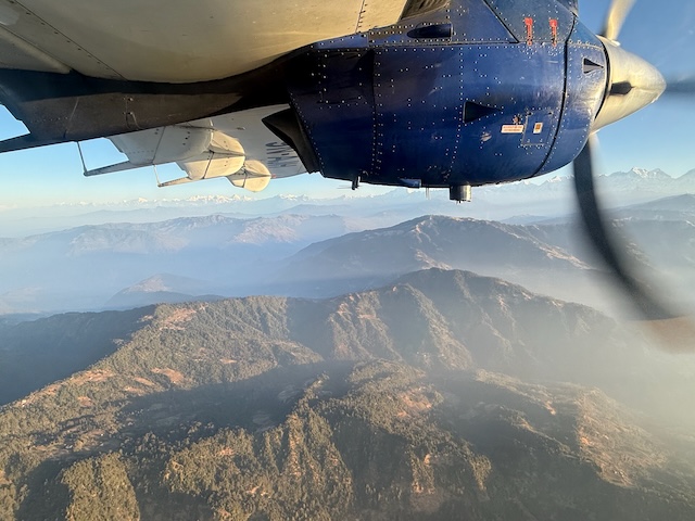
Stuuning early morning views

We set off as the sun was rising, and although the views out of one side of the plane were muted, the other side (opposite to mine) was pretty spectacular… and that was just the start of them.

The flight was not at all bumpy, although the plane looked like it was made of tissue paper. The landing into what is called “the most dangerous airport in the world” was as smooth as we could have wished for.

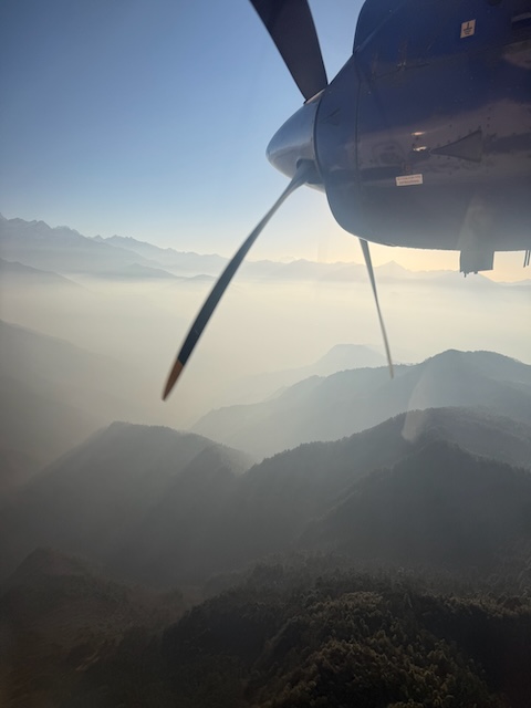
The dark side

Hey, it wasn’t all that bad on the shady side either. Two sides of the same coin I’d say. Either way the views set us up nicely for the spectacle that was to come.

Lukla

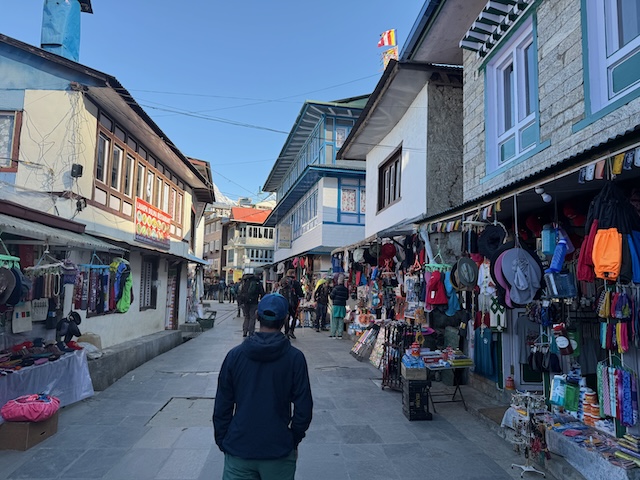
Lukla itself is a pretty town, very vibrant, with loads of bars. That made a lot more sense on the way back, as it’s clear that nobody wants to be drinking alcohol on the ascent. Once we returned, we checked out some of the local establishments.

Based at an altitude of 2,860 metres above sea level, it primarily acts as the starting point for most treks to Everest Base Camp. It is also the main entry point to the Khumbu region.

Its population are primarily Sherpa, who practice Tibetan Buddhism. From here, the majority of supplies for the entire mountain region are carried by porters, mules, and yaks (more so at high altitude).

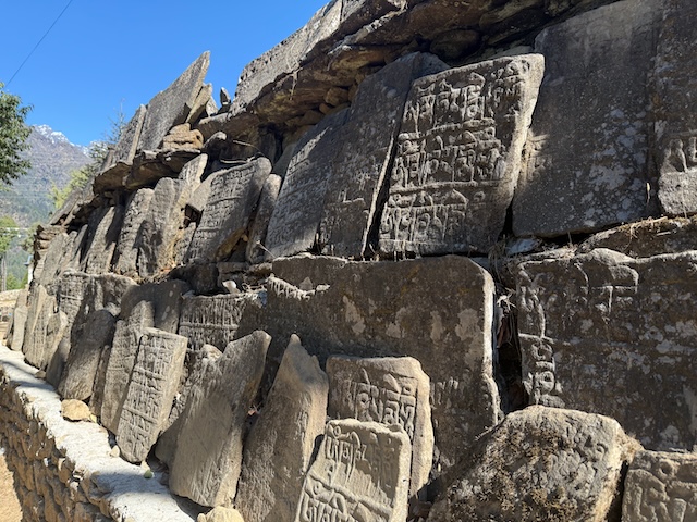
Stone Carvings

Nepal is a Buddhist country, and the people are obviously very devout. Our trekking guide, Ngima, taught us about their superstitions around passing any of these structures anticlockwise. It’s supposed to bring bad luck. The same applies to the prayer wheels, which should always be spun in a clockwise direction.

The stone carvings here are made by monks in the many monasteries all over Nepal and are called Mani stones. The chant carved into them is “Om Mani Padme Hum.” You’ll see a lot of pictures of it here, as we encountered them so many times.

It’s pretty awe-inspiring to think of the meticulous effort put into creating all of these.

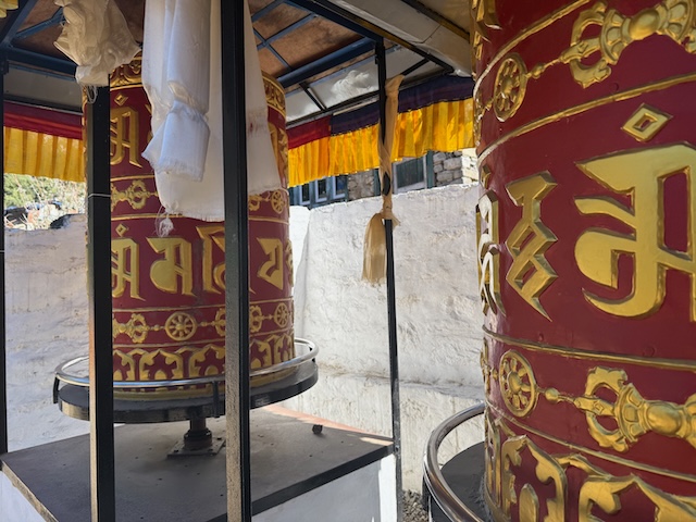
Prayer wheels

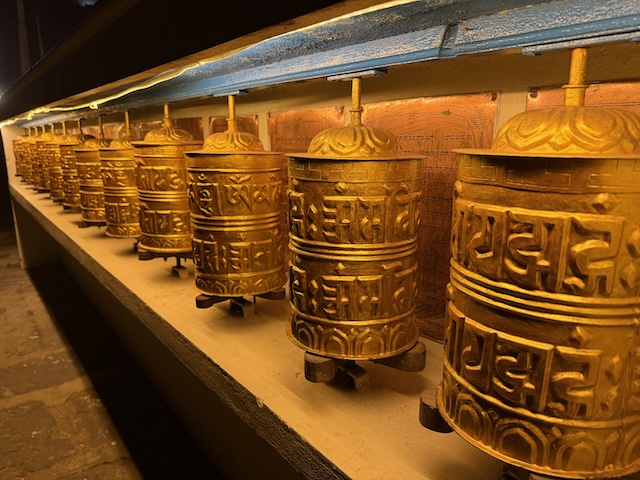
There were plenty of prayer wheels dotted along the route. Some were twice as high as me, others about the size of a hand. Turning the cylinders, which are inscribed with mantras, is considered equivalent to reciting them.

Spinning the wheel clockwise is believed to release the prayers into the universe, generating merit, purifying karma, and helping focus the mind. The locals visit them regularly to spin them—it’s part of their routine on the way to and from work.

Their spiritual nature was really inspirational. Everyone was so content—it’s humbling.

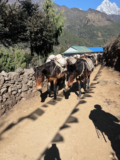
These are the real workhorses

Although technically they are mules, there are no roads once you get into the Himalayas—just dirt tracks. The only way to transport anything is on the backs of humans or animals.

In the lower sections, the hard lifting is performed by herds of mules. They were all so chilled, and you could see how well they were treated by their owners—no open wounds or heavy chafing.

It was always so nice to see them approach, and as good trekkers we all made way for them to pass. Top tip on the mountain: always keep the mules on the drop side of the path, as they are much better at ensuring they don’t fall.

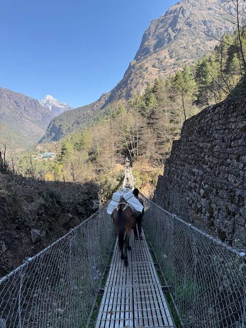
They are also expert bridge crossers

The first rope bridge we came to made a lot of hikers nervous—but not the mules. They take everything in their stride. True professionals!

The herders are very entertaining. The sounds they make to control the movement of the herd are hilarious—not that they are doing it for show. Apparently, they own these mules from cradle to grave and form strong bonds with all of them.

That’s why the mules listen to them and respond accordingly. There are no stubborn mules on this trail, that’s for sure! (except perhaps Sandro ;) )

Everywhere's a photo op

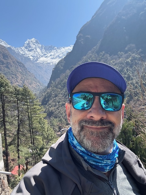
At lower altitudes below the tree line, the views were great but similar to what you can see in most mountainous regions—lots of nature and deep ravines.

But every now and then, you were given a glimpse of the true glory that was to come. It was very exciting to see the snow-covered peaks emerge.

Trekking friends

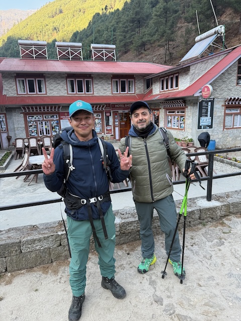
Our trek guide, Ngima, was such a great guy—very knowledgeable and tuned in to everyone’s needs.

We had the luxury of porters to carry our bags between teahouses where we stayed each night, but Ngima carried his all the way.

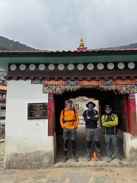
Sandro, on the right, was one of the three of us in our trek group. He had just landed by the time we had to make our way out of Kathmandu, so he was still getting used to the joys of Nepal.

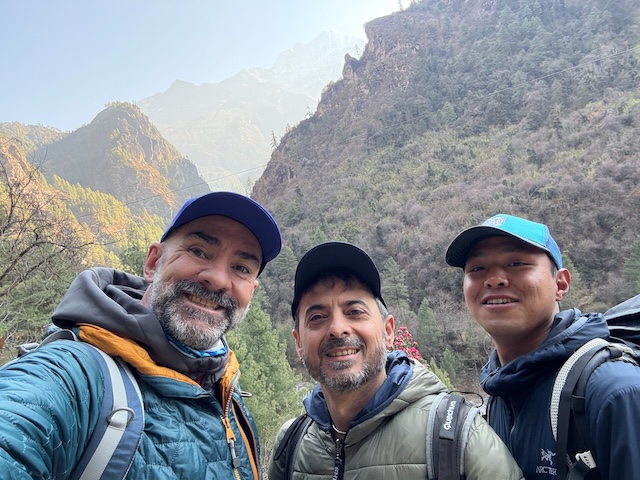
It's better when you're having fun

As I mentioned, the views at lower altitude were amazing—but they were only made better when you introduced three studs into the mix. We all got on so well and had plenty of fun as we made our way up the mountain paths.

We actually got Ngima as our guide because a last-minute change of plans meant we had to start our trek a day later than originally scheduled. The result was that we had a private trek with the best guide and porters. Funny how things work out in the end.

Rope bridges

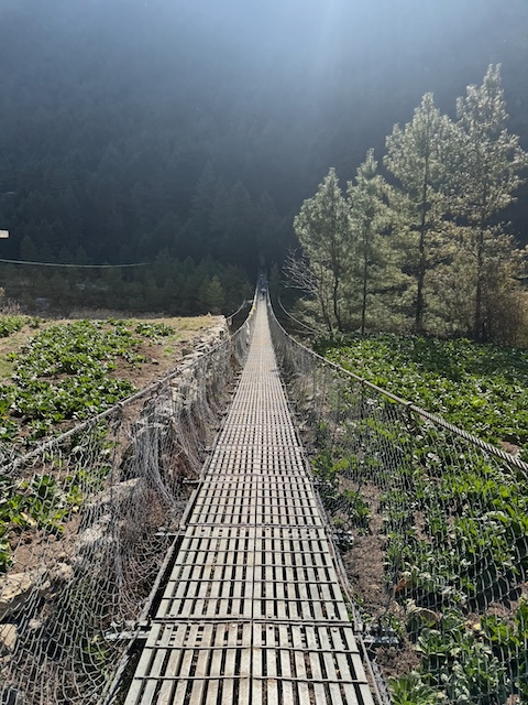
The rope bridges were so stable, it surprised me. Some of them were very long and incredibly high over the ravines.

We crossed the final bridge before a tough two-hour ascent up a series of stairs and steep forest dirt paths en route to Namche Bazar, which is the capital town of the mountains.

Namche Bazar - The capital of the mountains!

After what was billed as the most gruelling two hours of one’s life—climbing an immense amount of stairs—we reached Namche. (Spoiler alert: it wasn’t that bad with trekking poles.) Regardless, it was a relief.

We would spend two days here acclimatizing to the altitude in preparation for the next phase. We could also explore the tiny streets and many stores to plan our shopping spree on the way back down.

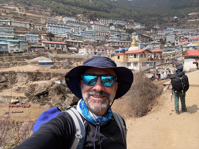
Namche Bazaar is often called the gateway to Everest—it’s one of the major stop-points for trekkers heading up to Everest Base Camp or into the high Himalayas. It’s nestled into a horseshoe-shaped hill, giving it excellent views of many Himalayan peaks, and it sits at an altitude of 3,440 metres.

You can smell the relief

Before I departed for the trek, I had a dodgy knee from too much cycling. It stopped me from doing a lot of prep work for the trek, as I decided it was better to be underprepared with a working knee than to try it with a limp.

I was pretty concerned that this section would finish me and I’d have to give up, but those poles saved my life—and my knee actually felt much better for it. Hence the relieved smile.

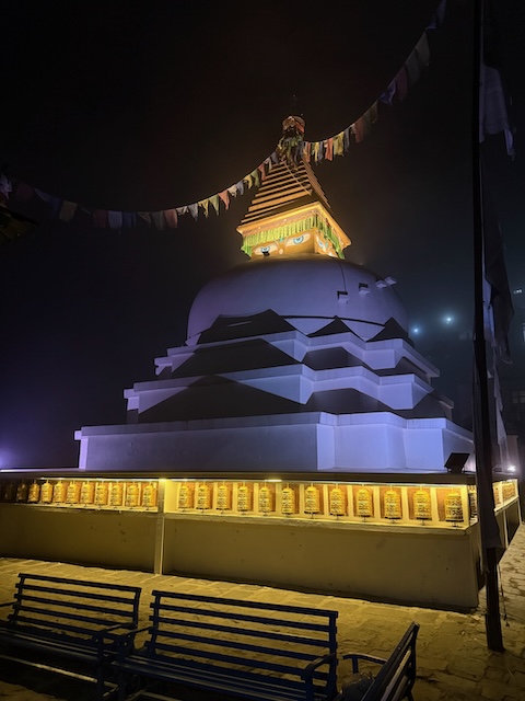
The Namche Stupa

Stupas are Buddhist religious monuments. They represent the universe and the enlightened mind of the Buddha.

In Nepal, these are built on tiered square bases that symbolize the elements—fire, earth, air, and water—which are also represented in the coloured flags that fly all over the mountains. From an aerial view, looking down, the stupa takes on a mandala shape.

At the top of the stupa there is a tower called a harmika, which is decorated with the eyes of the Buddha on all four sides. This one also has golden prayer wheels dotted all along the base on all four sides. It is there to ward off evil spirits from entering towns or villages.

And remember...

Always spin those prayer wheels in the clockwise direction or you’ll get bad luck. I span one anti-clockwise and soon after stood in some cow dung. Conincidence? I suspect not ;)

First aclimatization day

One of the most important aspects of any high-altitude trek is ensuring that your body is fully acclimatized to the higher elevations.

One of the primary risks on the Everest Base Camp trek is altitude sickness, which can be fatal, so skipping acclimatization days can be very dangerous. Many trekkers end up being helicoptered off the mountain due to the effects of altitude sickness.

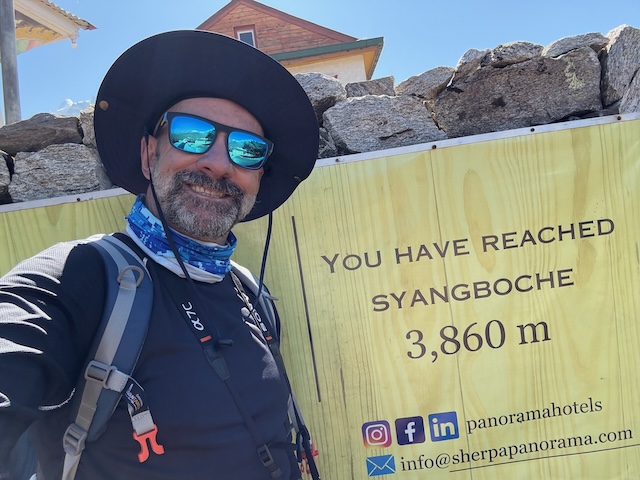
On our first full day in Namche, we made our way to the Everest Hotel viewing platform, which is located at 3,860 metres. That was the highest altitude I had ever reached; my previous record was Mount Teide on Tenerife, which is 3,718 metres.

I’m not going to say it was easy. As we started to climb, we were acutely aware of shortness of breath. We also had a great view of Everest and the surrounding peaks. We were very lucky, as the weather was perfect.

The first Yak

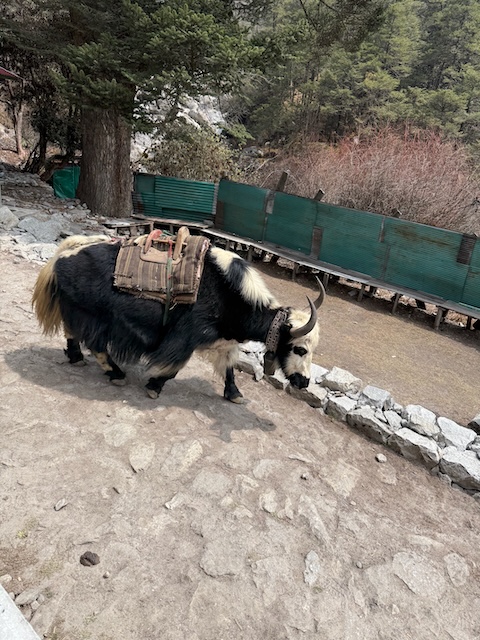
One of the initial highlights for me was spotting my first yak.

These glorious beasts are used at very high altitudes to carry heavy loads all the way up to Base Camp.

We had stopped for lunch when I heard a bell and expected to see a herd of mules, but instead, it was a yak. I grabbed my phone and took a quick snap for posterity.

The other Stupa

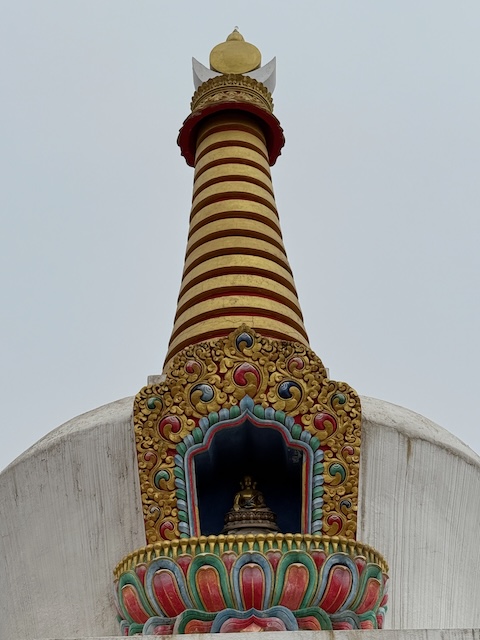
Along with the stupa we encountered in Namche, there were similar stupas dotted along the trek.

This is a Buddhist stupa (chorten), a very common type of shrine found throughout Nepal and the Himalayan region. The conical spire represents stages of spiritual attainment, with each ring symbolizing a step toward enlightenment.

The disk and crescent moon, surmounted by a sun symbol, represent wisdom and compassion united, and the ultimate attainment of enlightenment. For this particular stupa, the Buddha statue shows that it is not just symbolic architecture, but also a devotional shrine containing an image of the Buddha. Some stupas can also hold relics or sacred texts inside.

The lotus design symbolizes purity and spiritual awakening, rising from the “mud” of worldly existence. Almost every village along the route had these stupas at the entrance or in multiple locations on the hilltops surrounding the villages.

Every day delivers a nice surprise

After leaving Namche, where we spent two days acclimatizing, we climbed to the village of Tengboche, which is famous for the Tengboche Monastery (Dawa Choling Gompa), the largest monastery in the Khumbu region.

The monastery is an important center of Tibetan Buddhism and plays a significant role in Sherpa culture. It’s also renowned for its stunning backdrop of peaks—Ama Dablam, Everest, Lhotse, and Nuptse.

We arrived early, which meant we had time to eat our meals and then head to the monastery to listen to the monks performing their evening chants—a truly wondrous experience. The art on the walls inside the monastery is incredibly colorful. I will probably create a separate story based purely on the monastery art we witnessed across Nepal.

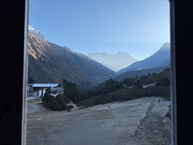
Aside from that, we woke up after a great sleep to witness an amazing view from our bedroom window. The peak on the left in the middle background is Everest, and the peak to the right of Everest is Lhotse, the fourth-highest mountain in the world.

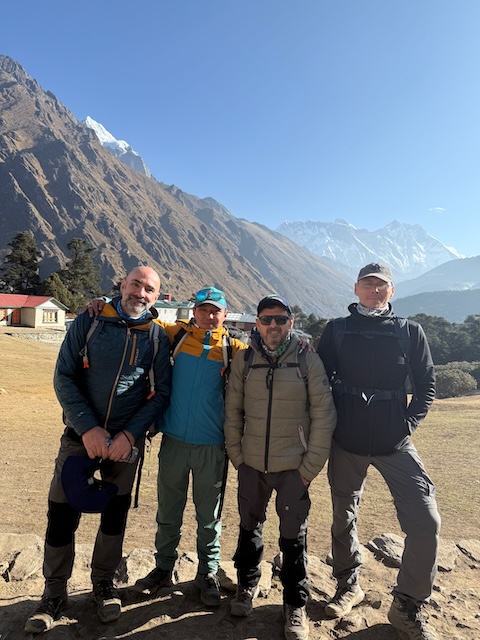
Our first group photo

can't believe it took us so long to get one, but this was actually the first full group photo we had taken on the mountain, including the three of us with our guide, Ngima.

This photo was taken after breakfast in Tengboche, with our goal, Everest, in the background.

Land of dust

Once we started to climb above Tengboche, the trees began to disappear, and we knew we were above the tree line—the altitude at which trees can no longer survive and the air really starts to thin.

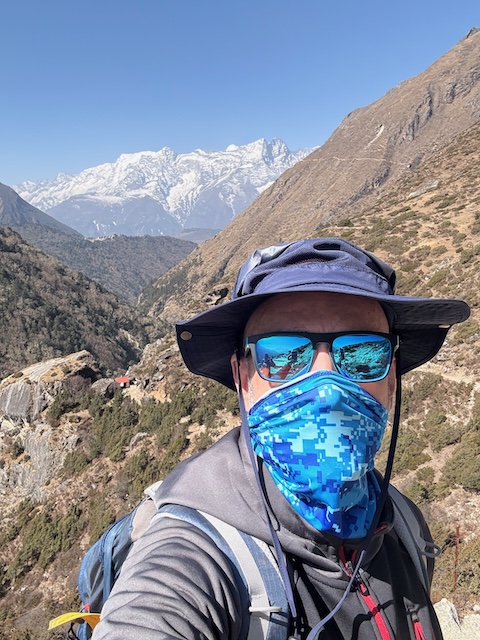
We were walking slower, following the expert advice of our guide. With no trees to block the wind, it started to pick up, whipping up a lot of dust. From here, there were many selfies taken with mouths covered.

The ground was almost worn down to a desert, as most of the juniper bushes are either eaten by roaming herds of cows or picked by monks to burn as offerings to the gods. This is probably an indication of the effects of climate change, which, as we all know, are far-reaching.

From here the views ramped up

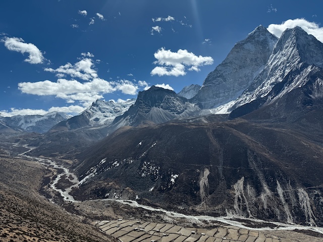
At almost every turn, there were spectacular views.

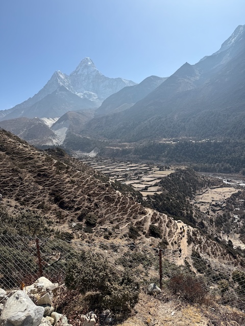
In this view down the valley, the scene ends with the peak of Ama Dablam (6,812 m / 22,349 ft). Ama Dablam is a striking pyramid-shaped mountain with a sharp, elegant peak, often called the Matterhorn of the Himalayas.

It rises prominently above the valley on the route from Tengboche toward Pangboche and Dingboche. While Ama Dablam is not among the tallest Himalayan giants like Everest or Lhotse, it is one of the most recognizable and photographed peaks in the Khumbu region due to its distinctive shape and commanding position.

More Yaks

As we made our way to Dingboche, we took an excellent diversion to visit the oldest monastery in Nepal.

Most trekkers didn’t take the diversion, so we basically had it all to ourselves.

When we arrived at the monastery, the head monk was at home with his family having lunch (yes, some monks in Tibet are married with children!).

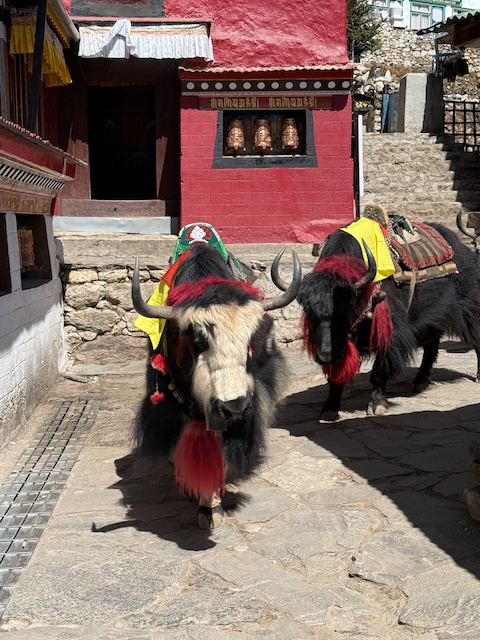
As we waited for him to arrive and open the monastery for us, we were greeted by more glorious yaks. They just wandered past on their way to get some water. Gawd, I love the yaks!

The Pengboche Monestary

We took a diversion to visit Pangboche Monastery, located in Pangboche village, above 3,900 m on the Everest Base Camp trail.

The monastery is one of the oldest in the Khumbu region, originally built in the 17th century. It is famous for housing a relic known as the “Yeti scalp” (sometimes also described as a hand relic). For decades, it has been shown to trekkers and climbers, including early Everest expeditions in the 1950s. Scientific examinations later suggested it was made from animal parts, such as the hide of a serow, a Himalayan goat-antelope, though locals still treat it with spiritual respect.

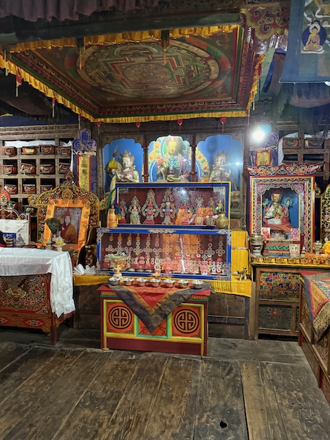
The monastery is very small, but inside it is filled with amazing artifacts, apart from the Yeti relic. The prayer books in the slots to the left of the picture were moved from Tibet during the Chinese invasion and are over 800 years old. On the ceiling above the altar, there is a mandala.

In Buddhism, a mandala is a symbolic, often circular representation of the universe, the enlightened mind, or the path to enlightenment. It carries deep spiritual and ritual significance. The symbolic meaning can be broken down into four areas:

Universe: The mandala represents the cosmos, showing how everything is interconnected.
Inner journey: It symbolizes the mind of the Buddha and the journey from ordinary consciousness to enlightenment.

Balance and harmony: The geometric patterns often have symmetry, reflecting balance in the universe and within oneself.

Spiritual function: A mandala serves as a meditation tool, helping practitioners develop mindfulness and concentration. It is also used in rituals to invite blessings, protect sacred spaces, or consecrate objects. Additionally, it is a tool for visualizing enlightenment: the center often represents the ultimate truth or the Buddha, with layers representing various teachings and obstacles on the path.

Altitude energy

The Sherpa people are very adept at harnessing energy from wherever possible.

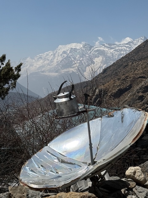
All electricity in the mountains comes from solar panels, which are limited. To conserve that limited energy, they have a very novel way of boiling kettles of water using dishes that concentrate and direct sunlight straight onto the base of a tin kettle. Very impressive stuff.
Onwards we go

We were getting tired at this stage, as we had been walking for a long time at high altitude.

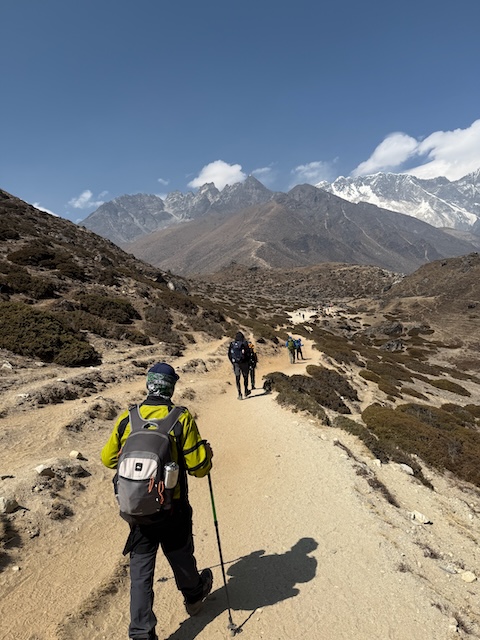
You can see here how the ground is almost completely dried out from the sun and the lack of shrubs to keep it compact. The dust was crazy. You can also see how the paths are filled with a continuous stream of trekkers (and this was just the start of the trekking season; in late April and May it gets extremely busy).

After a long walk, we finally arrived at Dingboche, which would be our penultimate stop. It was also our last acclimatization point, where we would spend two nights.

The most photographed rock in Nepal

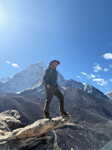
Popularly known among trekkers as the “Dingboche Rock,” or sometimes the “Selfie Rock,” on the Everest Base Camp trail.

It’s located just above Dingboche (≈ 4,410 m) on the acclimatization hike that most trekkers do, usually up Nangkartshang Hill, which rises to approximately 5,100 m.

Many groups stop at this exact rock because it juts out dramatically over the valley and makes for iconic photos with Ama Dablam—the peak behind—as the backdrop. It’s not an official landmark with a historic name, but rather a trekker’s nickname and photo spot that has become famous through shared EBC trek photos.

Everywhere is breathtaking

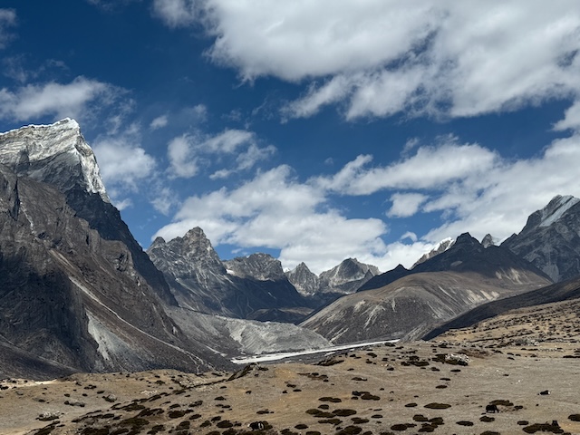
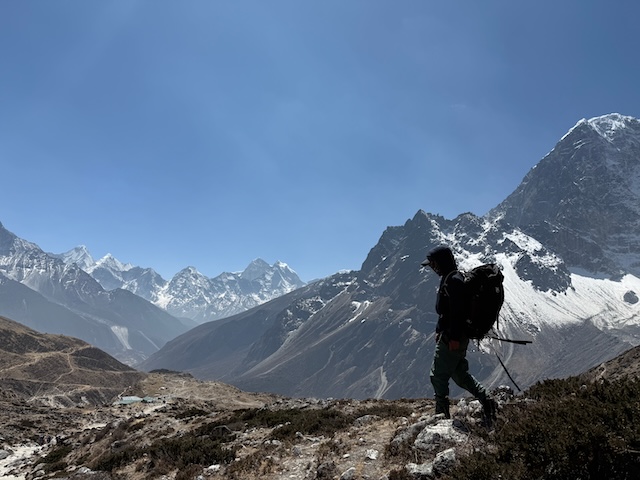
I said it before, but it’s worth repeating: everywhere you look in the Himalayas, there is a spectacular view.

I snapped this one from the peak of our second acclimatization climb. There are only a few places I’ve been where what you photograph matches what your eyes see—Nepal is one of those places.

Case and point

And just to prove a point ...

The glorious morning

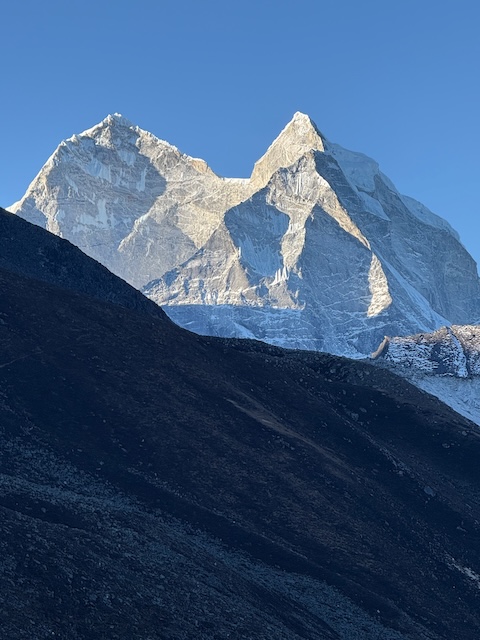
After our final night in Dingboche, we awoke to this spectacular view from our teahouse bedroom window.

It’s the twin-peaked mountains of Taboche (6,495 m) on the left and Cholatse (6,440 m) on the right. These two peaks form a dramatic wall above the Imja Khola valley. Taboche has the slightly broader summit and sits closer to Dingboche.

I initially confused them with Ama Dablam, but after checking with our guide, Ngima, I was corrected.
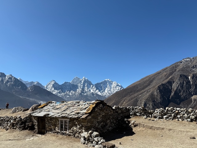
The house

Okay, so this is a bit of a ramble—please bear with me.
You probably don’t remember, but at the very start of this section I mentioned that some of my HP colleagues went on the EBC trek years ago, and it was that which sparked my interest in doing it.

To expand on that, one of the girls who went on the trek, Linda, I shared a house with. When Linda came back and showed me her photos, I was blown away. However, one photo completely blew my mind—it was of this house. To me, it looked like something out of National Geographic magazine. I could not stop thinking about this house for years.

Anyway, when we left Dingboche and started to make our way to the next destination, we passed the house. I couldn’t believe I was standing next to—and even touching—the place that inspired me to come here in the first place. It was kind of a spiritual moment for me.

I tried to recreate Linda’s excellent image, but there were just too many people around. Gawd damn those trekkers! :)

Our guide

No trek to Everest Base Camp can run smoothly without the dedicated support team that works tirelessly in the background (and foreground) to ensure everything goes according to plan.

We trekked with Soul Encounters Trek https://www.soleencounterstrek.com/, and every single person we came into contact with was more than professional and helpful.

The team we trekked with included Ngima (guide) and Budhha and Bowa, who were our porters. They all worked extremely hard, especially Ngima, who had to deal with our constant questions and very bad dad jokes all day, every day—all while carrying his own backpack.

His smile never waned, and he ensured that all of us were fully prepared along the way so we could reach the end. I took this picture of him near the last stop before Everest Base Camp.

Base Camp

After nine days of trekking through the Himalayas, with plenty of laughter, panting, dust storms, and Dall Bhat, we finally arrived at our destination.

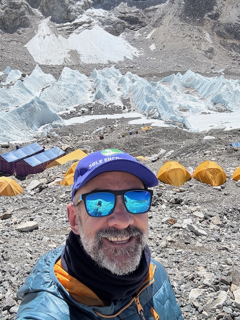
Everest Base Camp is, as the name suggests, right at the base of the peak. There are technically two base camps—one on the Tibetan side and the other in Nepal. Base Camp (Nepal) is situated at an altitude of 5,364 m (17,598 ft). It acts as a staging point for climbers attempting the South Col route, the most popular way to the summit.

Although it’s not a permanent village, each spring teams set up tent cities with kitchens, medical tents, communication domes, and climbing gear. When the climbing season ends, it’s all dismantled. For us trekkers, reaching Base Camp is the destination in itself. The trail didn’t require any climbing skills, but it involved high-altitude hiking. The pure sense of relief upon getting there in one piece was emotional.

Something I was not aware of is that Base Camp is actually built on top of a glacier. As we walked, you could see the ice underfoot—not like a typical glacier you would expect, though, as there was lots of gravel on top.

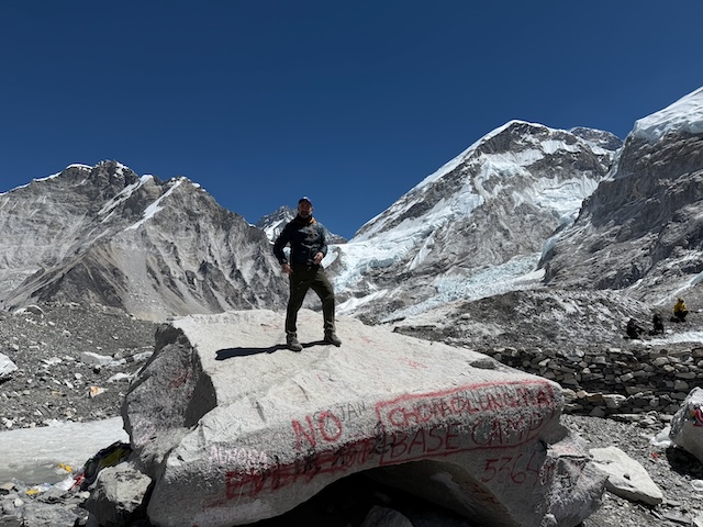
This is the famous Base Camp rock. It is normally marked “Welcome to Everest Base Camp,” but a few weeks before we arrived, it had been renamed [in an act of alleged Tibetan vandalism] to “Chomolungma,” which is the Sherpa and Tibetan name for Everest. Since we arrived very early, we had free rein to roam the public areas. Trekkers are not allowed to enter the tented area of Base Camp.

That is Everest to the right of me—it looks tiny in the picture, but it rises another 3,485 m above Base Camp to the peak.

The camp

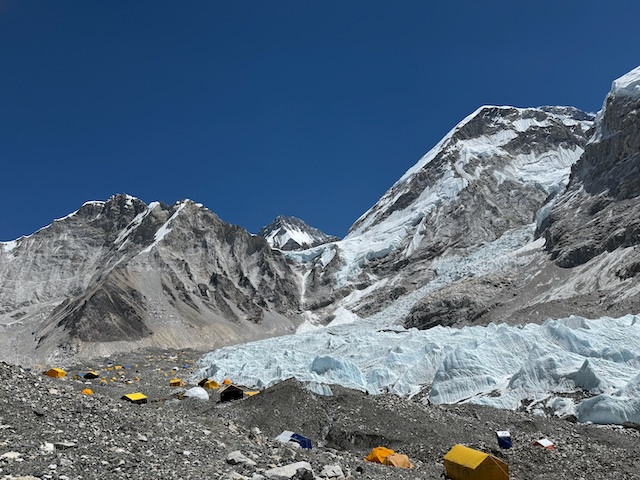
Base Camp itself is a bit of a sprawling metropolis, of which we only scratched the surface. This is as close as we could get to any of the tents, and in reality it was still in the early stages of being set up.

What’s crazy to think is that although there are 52 weeks in a year, the actual peak climbing season—the short window when climbers can reach the summit—lasts just two weeks.

In the background is the Khumbu Glacier, which forms the infamous Khumbu Icefall, one of the most treacherous parts of the climb to the summit. To think that at one time these peaks were a mountaineer’s nightmare, and today they’re just another photo opportunity, is surreal.

Khumbu ice fall

You can see the actual Icefall here in the middle of the photo, as the glacier makes its way down the mountain slopes.

From this angle you also get a real sense of the vastness of Base Camp itself. The tents wrap around the base and spill onto the sides of the glacier as it winds down and away from Everest.

Soundwaves

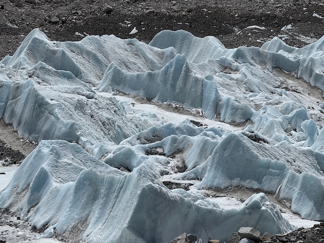
A close-up of the glacier in motion. The icy peaks were reminiscent of soundwaves, or the grooves on a vinyl record under a microscope — which feels kind of poetic, given that the glacier itself moves and makes plenty of noise as it winds its way down.

As we made our way toward Base Camp, we could hear the ice cracking and shifting beneath the surface. Nature doing its thing — and it was pretty awesome to witness up close.

The last minute change

We were supposed to head back to our teahouse after reaching Base Camp to spend the night, with a 4 a.m. start planned to climb Kala Patthar (5,655 m) and watch the sunrise over Everest.

But at Base Camp we bumped into one of our fellow trekkers from another group, who told us they were going up Kala Patthar that very evening to catch the sunset. Well, I’m a huge fan of sunsets, so for me it was a no-brainer. We were all in good shape, having reached Base Camp earlier than expected, so we decided to do the same — back to the teahouse for dinner, and then on to the climb.

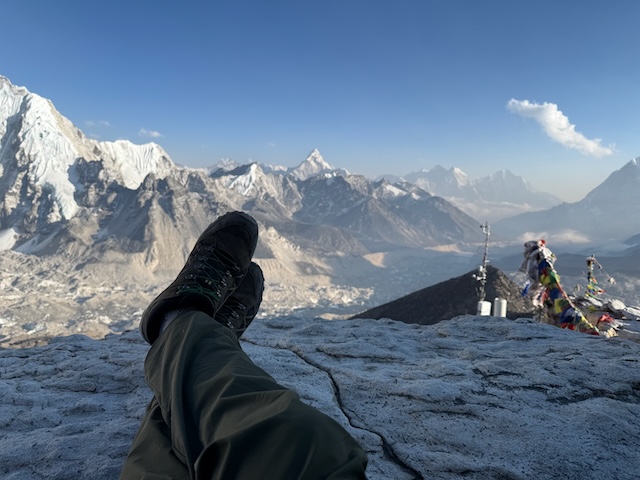
I’m not going to lie: the ascent to Kala Patthar was one of the hardest parts of the entire trip. The air was so thin that taking more than two or three steps without stopping to catch your breath felt impossible. By the time we reached the summit, the wind was howling and the temperature dropped fast — I genuinely thought my fingers might fall off.

And yet, as we waited for the sun to sink behind the peaks, I found a ledge to sit on. From there, the view down the valley was nothing short of incredible.

Sunset begins

As the sun began to dip behind the peaks, we could already tell this was going to be something special.

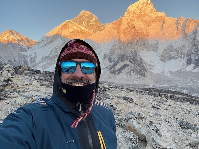
Even though I was in crazy pain from the cold and the lack of oxygen, I still managed to crack out a smile or two. Some moments are just too good to let discomfort get in the way.

It just got better

As dusk descended upon us the real show started

And better

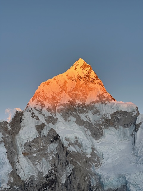
Not Everest — this is Pumori, which sits just west of Mount Everest and is especially prominent when viewed from Kala Patthar and Gorak Shep.

It’s sometimes called the “Daughter of Everest” (Pumo = unmarried daughter, Ri = mountain in Sherpa language). Its sharp, pyramid-like peak catches the alpenglow of the sunset beautifully.

That evening, the setting sun lit it up like a gold nugget — one of those sights you can hardly believe is real until you see it with your own eyes.

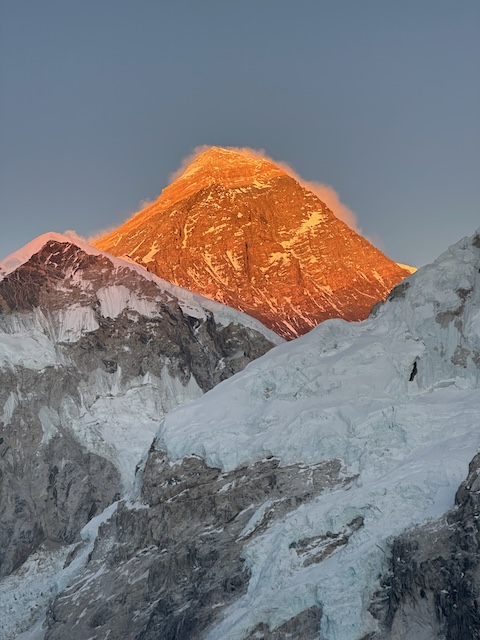
Nothing compares to the main event

I left the UK with two main goals in mind. The first was to see that little house outside Dingboche [achieved], and the second was to reach Everest Base Camp [achieved].

What I didn’t realise I wanted was to watch the sun set over Everest. I can only say that this turned out to be one of the most extraordinary spectacles of my life. Words don’t quite capture it, and even the photo — as beautiful as it is — doesn’t do it justice.

At 55 years old, I flew to Nepal to stand at the base of the highest mountain in the world. But in truth, it was everything I experienced along the way that left the deepest impression, far more than simply “completing the quest.”

I cannot recommend it enough — if you ever get the chance, book the flights and go.